Anyway here present the latest screenshots.
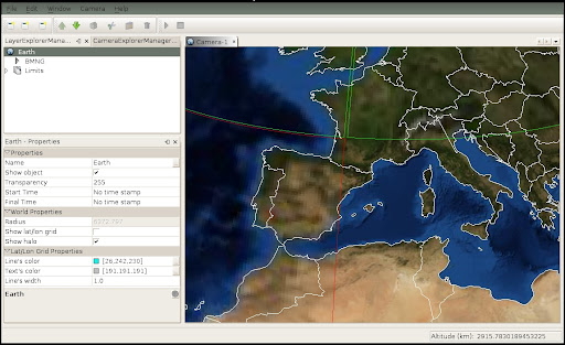
This image shows a one camera view: earth with one WMS layer (Blue Marble).

This one shows the first step to import a shapefile. The second step ask you for the attribute to be use as the name of the shapes. The file used here contains the limits of the world.

Next, you can see the earth with the imported shapefile data and how you can select and change on the fly the color and size of the points and polygons:

When you have WMS layers the tile's color brings you information about which tiles are loaded (no border), which are actually loading (green border) and which get some type of error while retrieving data (red border).
Next image shows a two diferent views (cameras) of the world. First camera shows the transport lines of the Barcelona city.
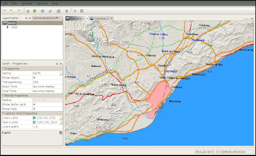
Second camera shows the transports for all Catalonia (Catalunya).

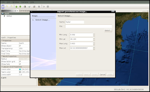
Here, we are going to import and geo-reference an image:
The transparency of the image has changed to see the underlaying Blue Marble layer:

Finally, here is a more complex combination of layers. At bottom the Blue Marble opaque layer. Over it a semi-transparent transport layer and on top of them the semi-transparent radar image.


